ABOUT NAMIBIA - Gov.na
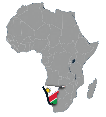
LOCATION

POPULATION
3,022,401
AREA
824 292 square kilometers
CAPITAL CITY
Windhoek
DATE OF INDEPENDENCE
21 March 1990
DENSITY
2.2 per square km, 240 000 inhabitants in Windhoek (15% of total)
OFFICIAL NAME
Republic of Namibia
OFFICAL LANGUAGE
English
GDP per capita
4,140.46 USD
TIME ZONES
GMT + 2 hours
LANDMARKS
Etosha National Park, Sossusvlei, Fish River Canyon
ELECTRICITY
220 volts AC, 50hz. Outlets are of the round three-pin type
CULTURES
Multi-cultural country 16 languages and dialects
SYSTEM OF GOVERNMENT
Multi-party Democracy
HEAD OF STATE

President H.E Dr. Netumbo Nandi Ndaitwah since March 2025
PRIME MINISTER

Dr. Elijah Ngurare since 2025
CONSTITUTION
Democratic Constitution, division of power between executive, legislature, judiciary
RELIGION
Freedom of religion was adopted through Namibia’s Bill of Fundamental Rights. About 90% of the population is: Christian.
PHYSICAL INFRASTRUCTURE
5450 km tarred roads, 37 000 km gravel roads
HARBOURS
Walvis Bay and Luderitz
CLIMATE
Average summer temperatures vary from 20-34⁰C (day) to 18⁰C (night) and in winter from 18-22⁰C during the day and 0-0⁰C (night)
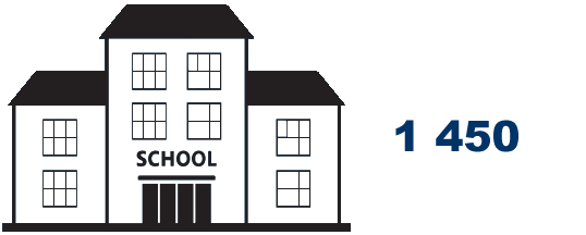
SCHOOLS

LITERACY
The current literacy rate in Namibia is about 83%, one of the highest in Africa.
MOBILE COMMUNICATION SYSTEM
GSM AND 3G (agreements with 117 countries/255 networks) - Direct dialling facilities to 221 countries - Postal service affiliated to Universal Postal Union
CURRENCY
The Namibia Dollar (N$): The Namibia Dollar and South African Rand are the only legal tender in Namibia and can be used freely to purchase goods and services. Traveller’s cheques, foreign currency, international Visa, Master Card, American Express and Diners Club credit cards are accepted.
ECONOMY
Main Sectors: Mining, Fishing, Tourism and Agriculture Biggest Employer: Agriculture (46%) Fastest-growing sector: Tourism Mining: Diamonds, uranium, copper, lead, zinc, magnesium, cadmium, arsenic, pyrites, silver, and gold, lithium minerals, dimension stones (granite, marble, blue soladite and other semi-precious stones).
RAIL NETWORK
2382 km narrow gauge 6.2 telephone lines per 100 inhabitants
MAIN AIRPORTS
Hosea Kutako International Airport, Eros Airport, Andimba Toivo ya Toivo Airport, Walvis Bay Airport and 44 airstrips
SOCIAL INFRASTRUCTURE
One medical doctor per 3 650 people - Two privately run hospitals in Windhoek with intensive –care units - Medical practitioners (world standard) - 24 hour medical emergency services
FLORA
|
FAUNA
|
ENVIRONMENT
|
HISTORY
Namibia’s history is engraved into carved rock paintings found in the south at Twyfelfontein, some dating back to 26,000 B.C. A long lineage of various groups including San Bushmen, Bantu herdsmen and finally the Himba, Herero and Nama tribes among others – have been making this rugged land home for thousands of years.
But, as Namibia has one of the world’s most barren and inhospitable coastlines, it wasn’t until the middle of the nineteenth century that explorers, ivory hunters, prospectors and missionaries began to journey into its interior. Beyond these visitors, Namibia was largely spared the attentions of European powers until the end of the 19th century when it was colonised by Germany.
The colonisation period was marred by many conflicts and rebellions by the pre-colonial Namibia population until WWI when it abruptly ended upon Germany’s surrender to the South African expeditionary army. In effect, this transition only traded one colonial experience for another.
In 1966 the South West Africa People’s Organisation (SWAPO) launched the war for liberation for the area soon-named Namibia. The struggle for independence intensified and continued until South Africa agreed in 1988 to end its Apartheid administration. After democratic elections were held in 1989, Namibia became an independent state on March 21, 1990.
To date, Namibia boasts a proud record of uninterrupted peace and stability.
